
In my quest to hike everything, my September vacation was full of some of the most beautiful, most intense hikes that the Swiss Alps have to offer. One of my personal favorites? A windy trail from the Lauterbrunnen Valley to high-altitude Klein Scheidegg.
The hike climbs over 1200 meters (4000ish feet) in altitude, crosses over the very pretty Trümmelbach Falle, and winds so steeply at parts that cables have been screwed into the rock for your safety.
In other words, it totally rocks.
And today I’m going to tell you how to find the trailhead and kick the mountain’s ass.
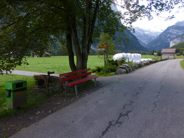
First, you’ll need to leave Lauterbrunnen and head toward Stechelbeurg on the main valley floor pathway (one portion shown above). When you come to a red bench and a bunch of signs, turn left toward the signs that point to Trummelbach Falls.
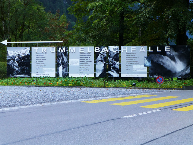
Keep following signs for Trummelbach and, once you reach the main entrance to the falls (shown below), pass it by.
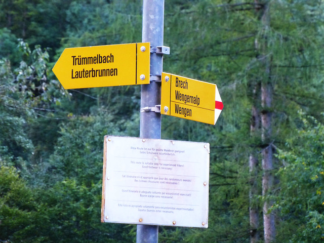
Instead, turn left where you see the signs for Brech, Wengernalp, and Wengen.
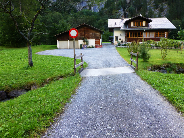
The turn will take you onto someone’s property. Cross their little driveway bridge and go left around the barn/garage.
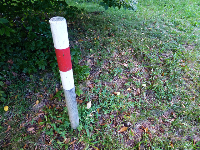
A stake in the ground will let you know you’re on the right track.
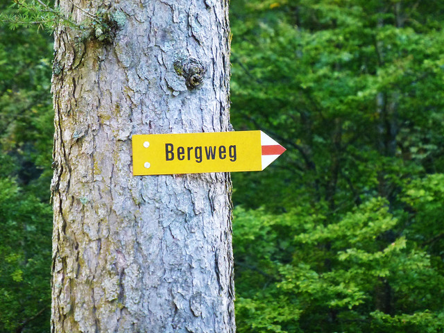
And so will a lovely little bergweg (mountain path) sign.
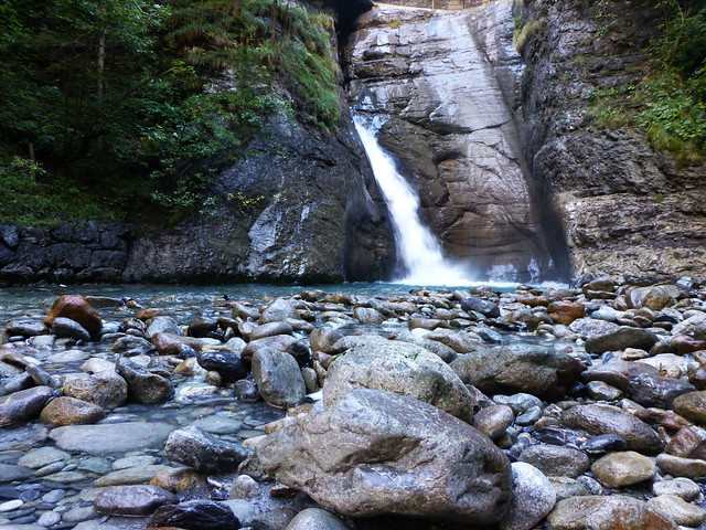
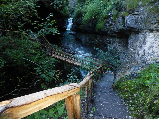
Before you hit the trailhead, walk a little to the left and check out the bottom of Trummelbach Falls, which is free and gorgeous.
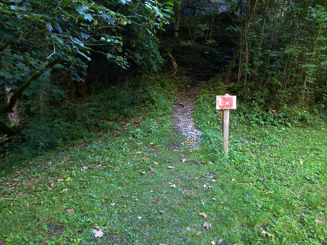
Then head back up the banks, where you’ll see the trailhead marked by a red warning sign. The sign (and now I) remind(s) you to wear proper footwear and not hike the trail unless you are an experienced hiker.
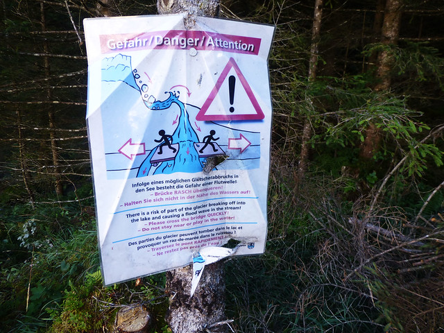
Hike straight up the mountain for forever and you’ll run into a danger sign. Note that if part of the glacier breaks off while you are hiking (unlikely, though possible), the little valley could flood. The sign encourages you to go through quickly.
Here’s the pretty valley.
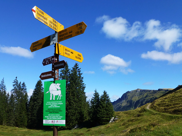
After that excitement, it’s more uphill until you reach the triumphant signpost that points to Wengen on one side of the mountain and Klein Scheidegg on the other. If you’re exhausted, head to Wengen and catch the train back down the mountain. If you’re feeling great, keep heading upward to Klein Scheidegg.
Keep following signs for Klein Scheidegg until you come to this one. After this signpost, the road splits rather confusingly. A wide road goes straight from where the sign points and a narrower path juts off it to the right. Take the narrow road, which is only labeled as a wanderweg or bergweg.
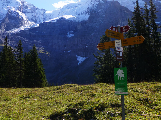
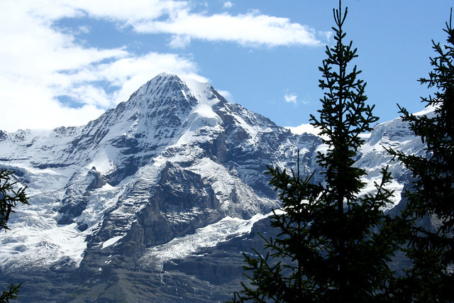
Before you know it, you’ll be in the shadow of the region’s most famous peaks.
Going to Switzerland? My full-sized Switzerland guide (with 100 local interviews) just published! Get your copy now.
20 comments
Gigi this looks like the answer to a long week. Fresh air, lots of rich color, refreshing spots for a respite. Ahhhh!
For sure!
Gigi….oh my! What a terrific post! Feasting on those colors…
Thanks!
SUCH good memories there. :) Great post and amazing photos!!!
Yay!
Ahh now you have made me home sick granted wrong country but, still lovin the mountains. Great pictures. Some serious drooling on my part and missing.
Glad you are enjoying yourself.
Thanks!
I’ve never seen a hike with such impressive signage! Does this mean it’s fairly “touristy?” Do you see many others on the trail? I like my hikes peppered with just a few reassuring faces and plenty of solitude…either way, what a dreamy vacation! And 4k+ is something to be very proud of. :)
Excellent questions. All the hikes in this region are really well marked (which is sooo nice), but not terribly crowded (which is also so nice!) – at least when I’ve hiked them (which has been in August and September the last couple years). Generally I see one or two other hikers per trail (a few more on the more popular trails or near the tops of the trails where some of the folks who ride the train up hike down for ten minutes and then back up), but for the most part feel like I’m completely secluded until I get to the top.
For this particular trail, I only saw one other person until I got to the top 20 minutes (at which time I saw a smattering of people who’d ridden up on the train and hiked down to picnic away from the town).
I’ve done this hike too and everything about it is so beautiful. I ran across a herd of cows, each wearing a very large cowbell. So Swiss.
The entire Lauterbrunnen Valley is full of hikes this nice. It’s really hard to choose a favorite. Everywhere you look is one amazing vista after another.
P.S. On this same vacation, I also flew a balloon from Stechelbeurg to Milan, Italy. The best day of my life (so far).
Holy crap! How did you find the balloon flight? I haven’t seen any balloons around here.
looks like an incredible trip! Beautiful photos- thanks for sharing!
Thanks!
[…] hiking trail in less than five minutes. And, of course, this means I spent a lot of time hiking. I explored old favorites and discovered new ones. I slept under the stars in the high alps. And I spent many an afternoon […]
Hi Gigi,
How long did you take to do this hike? Great photos btw! Really loved this informative post!
Maybe 3 – 4 hours. I can’t remember exactly. :)
[…] Wind your way through watery gorges, up steep mountain trails, and past views like the one above until you reach a fabulous restaurant with a view of the region’s three most famous peaks. […]
Hi do you know if it’s possible to do this hike in March ?
Depending on the weather, you should be able to do it year-round (you would just need different gear, obviously, in cold or snowy months). I would check with the local tourism office about weather conditions before planning your hike and perhaps consider hiring a guide if the conditions are not ideal.