Hiking from Kotor to Vrmac Fort
I love Kotor.
Let’s start there.
The expansive bay surrounded by towering mountains, alternating gray slabs of rock and bright green foliage. The tiny red-roofed town that’s so much bigger inside than it seems from outside. And the hiking trails that wind steeply, switchbacking up into the hills.
One of those trails starts just across the bay, about a 15-minute walk from Kotor (Montenegro) and it leads to an abandoned, overgrown fortress.
Here’s how to find and conquer it.

You’ll find the trailhead just inside the city limits of the town of Muo. It’s conveniently marked on the map and indicated by a road sign pointing up into a neighborhood. Look for the word Vrmac and you’ll know you’ve found it.
As you start to make your way up into the neighborhood, watch for red and white markers – these are the trail markers you’ll be following up to the fort.
The first section of the trail is a series of staircases through a quiet neighborhood which then turns into a dirt track. Eventually, the markers will lead you to a large road. From here, there’s a house to your right. We had some trouble finding the trail marker here, so pay special attention. You want to go up and to the left of the house (not in front of the house where another trail winds past a couple houses and into a field; don’t ask me how I know).
After that, the trail is pretty self-explanatory. It switchbacks up the mountain in a sharp zig-zag. You won’t see many trail markers, but there aren’t many ways to get off the trail unless you’re really not paying attention and decide to go crashing through the forest.

Eventually, the switchbacks dump you off onto a fire road, where you’ll make a right, and about 10 minutes up the road you’ll find the abandoned fort.
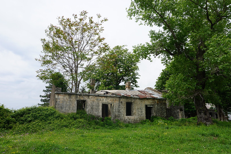
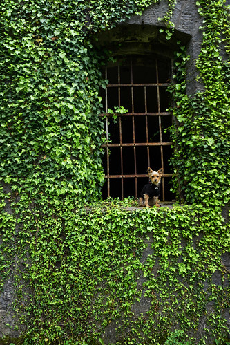
Now, when I say fort, I don’t mean fortress. Don’t expect Medieval turrets or visions of knights. This fort was built in the 1800s and used in WWI. It’s been abandoned long enough that nature has taken over now. Ivy twines up the sides and around mean-looking rusted spikes poking out of the ground (be careful where you step).
Nearby, other abandoned buildings (houses? Barracks? Guard posts?) lie in various states of ruin, overlooking the bay and the airport with trees growing through their concrete and thorns wrapped tightly around their bases.


It is, in short, everything I love. Abandoned places. Nature reclaiming the things we humans have left behind. Uphill hikes through changing landscapes. Sweeping, triumphant views from the top.
And for those who don’t want to (or can’t) hike, there is a road that leads to the top. I’ve heard it’s narrow and tricky to navigate. But it’s there.
One-way, the hike takes about two hours (a little less if you’re fit and fast, more if you’re stopping for photos or rests frequently). We left mid-morning and packed a picnic to eat at the top, overlooking the bay, which was well worth doing.
For those looking for a longer day-hike, you can turn and walk along the ridge once you get to the fort.


Happy hiking!
All photos taken with my Sony a6000.
Comments
-
Mary
Hi Gigi
Beautiful. What was the temperature? -
Peter
Looks great! We are in Muo now so will give this a try; is it suitable for kids (7 and 10)? We made it to the top of the Kotor fortress if that’s any indication?!

Mark
Cool. Great pics. Thanks for sharing.